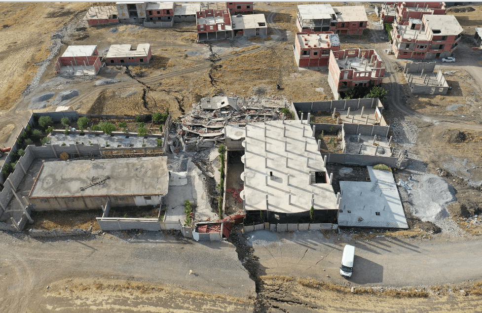
The massive Mila landslide of 2020
Following the August 2020 earthquake, a major landslide was triggered in Mila, located in northern Algeria. Our firm undertook comprehensive monitoring of the site, covering a total area of 280 hectares using drones, while also conducting in-depth geotechnical investigations across the entire affected zone.
The main actions carried out included:
- Digitization of a 280-hectare area using drones.
- Detailed analysis of the collected geotechnical data.
- Comprehensive slope stability assessment and continuous monitoring via drones, enabling precise zoning of high-risk areas.
These measures provided a clearer understanding of the destabilization mechanisms and delivered critical data to support risk management decisions and urban planning in the affected region.